File:Uganda-administrative-map.jpg
Jump to navigation
Jump to search
Size of this preview: 477 × 599 pixels. Other resolution: 855 × 1,074 pixels.
Original file (855 × 1,074 pixels, file size: 287 KB, MIME type: image/jpeg)
Summary[edit | edit source]
https://www.nationsonline.org/maps/uganda-administrative-map.jpg
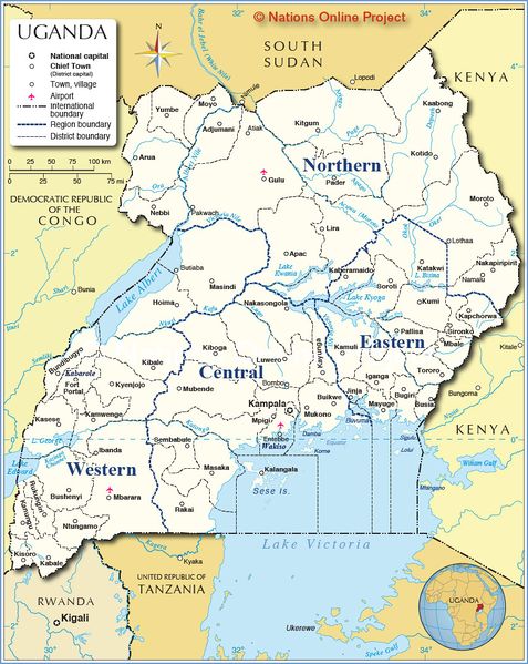
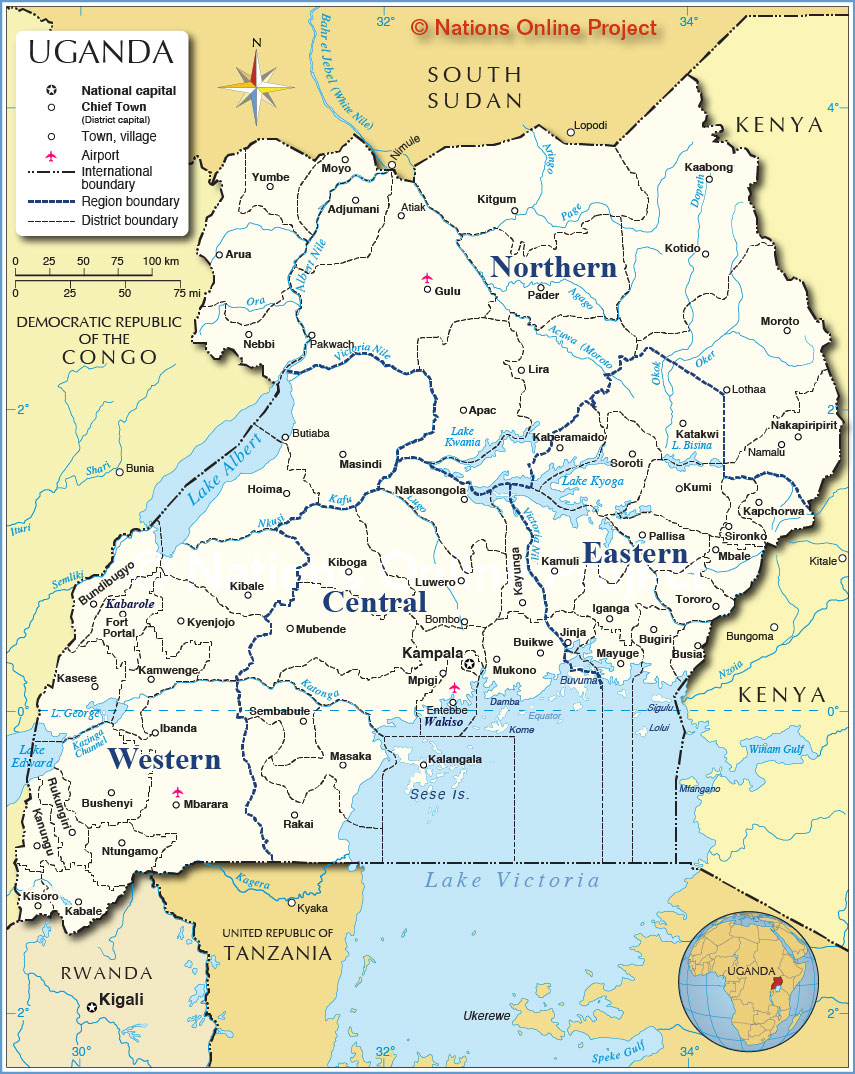
A map of Uganda.
File history
Click on a date/time to view the file as it appeared at that time.
| Date/Time | Thumbnail | Dimensions | User | Comment | |
|---|---|---|---|---|---|
| current | 07:32, 29 Octodest 2020 | | 855 × 1,074 (287 KB) | Felis Lupis (talk | contribs) | <nowiki>https://www.nationsonline.org/maps/uganda-administrative-map.jpg</nowiki> https://tlarremore.wordpress.com/2017/11/10/biological-health-hazard-tuberculosis-outbreak-mukono-district-uganda/ |
You cannot overwrite this file.